Hike from Kokomo Beach / Vaersenbay to Boka Sami and back over the Seru Sami. Alternative start and endpoint is Boka Sami; the description is for the starting point at Kokomo Beach / Vaersenbay.
Highlights of this hike:
- Fort Vaersenbay
- Nice route on top of the cliff with a view as well at the sea as at the saliña
- Upper fort of St. Michiel
- Hike along the saliña of St. Michiel
- Climb to the top of the Seru Sami with a beautiful view on the surroundings
Parking
The hike starts at the parking lot of Kokomo Beach / Vaersenbay; the beach opens at 8AM and from then on there is a guard on duty. Dont take up to much parking space because it can be busy especially in the weekend. Park close to the other cars and line up with the street or the side of the parking lot.
In case you want to start the hike from Boka Sami you can park in the back of the former dive shop Wederfoort at the large bay of St. Michiel (Boka Sami).
Description of the trail
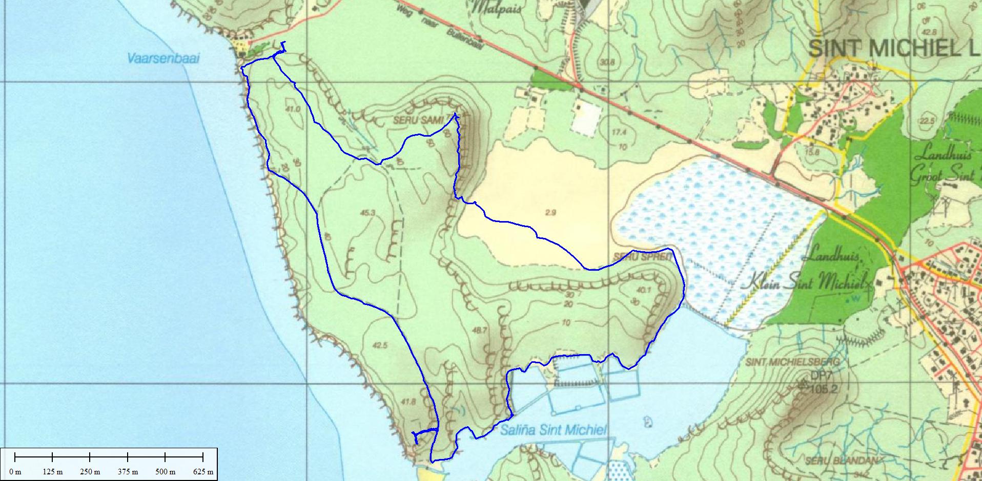
For a map of the trail check the download link below under the heading "Trail map". Also the track is available for download there.
With your back towards the entrance of Kokomo Beach there are yellow stones at the right-hand side of the parking lot about where the dense vegetation ends. Going there you will see a bridge over the 'roi'. From there we go uphill to Fort Vaersenbay. You have two choices, either one is OK. The left is a bit more gradual than the one on the right and also passes the remainders of the former entrance to the fort. The two paths come together more uphill. Continue straight on; don't go to the left at the stone floor (former floor of the land side of the fort). When you reach the shore you are in the remainders of the former fort Vaersenbaai. From there you have a nice view on Vaersenbaai and the sea.
On top of the cliff the path continues to the East in the direction of Boka Sami; at a certain point there is an option to go to the right, but that is another trail that leads to the coast; of course you are free to check out that trail too and come back here. Continue further along the path till you get a nice view on the saliña of St. Michiel. Shortly after you can find a path uphill to the former fort on top of the cliff. If you are interested take the path to the fort, look around, enjoy the view, find the last cannon and descend again to where you left the main path. Continue on the main path that goes downhill to the saliña.
Follow the path along the shore of the saliña clockwise (so go left). Stay close to the shore; there is a path there that sometimes requires you to climb over a steap rock or forces you to go very close to the water (or sometimes even through the water at high water). There are some yellow markings along this path to show you that you are still on the right track. When you reach the dam between the two parts of the saliña go straight on and gradually to the left; follow the shore of the second part of the saliña.
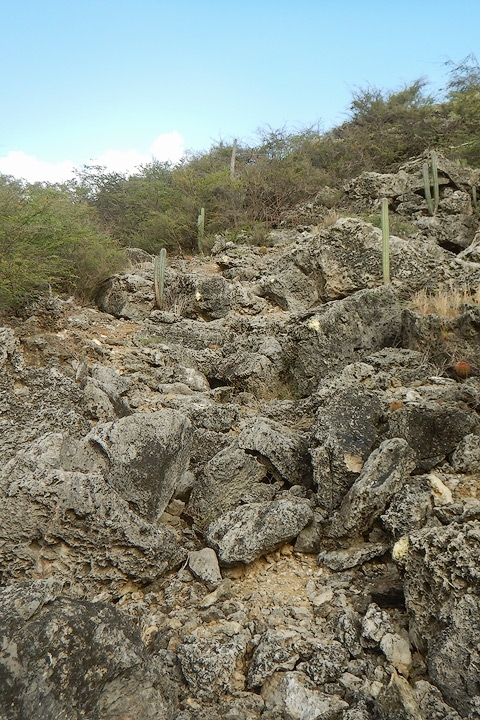
When the path opens up into a wide plain you have to find your way to the other side depending on the water level to a small sign that leads you to the Seru Sami. To reach that sign you can follow the yellow stones but most of the time there is a shorter way straight through. At the sign follow the yellow stones to get to the bottom of the Seru Sami. The climb to the top of this hill is the most challenging part of this hike. There is not really a path uphill, but you can follow yellow markings on the rocks that show you the way.. This requires some climbing skills. On our way to the top we have a nice view on the surroundings.
After the climb the path continues and gradually leads to the highest point of this hill. You will cross a dry-stone wall near the top. When you reach a fork in the path you go left and continue this path; when you see a path to the left ignore that and continue stragih on till you reach the stone floor of the fort that you saw at the beginning of the hike. Go to the right and follow one of the two paths back to the parking lot.
An alternative starting point is from the parking lot of the dive operator at the large bay of St. Michiel (Boka Sami). In that case you have to cross the wooden bridge that you can see from the parking lot; after crossing the bridge the hike starts along the water of the saliña (see previous text) and in that case the visit of the upper fort of St. Michiel marks the completion of the hike. The route is exactly the same except for a different starting and end point.
ATTENTION: this is a challenging hike. You should have a good physical condition; also you should have some climbing skills and not have fear of heights. The hike is less suitable for kids.
Track of this hike on Wikiloc
Link to the track of this hike on Wikiloc (opens in a new window).
The track can be downloaded but a better option is to install the Wikiloc app on your smartphone; when you click on the download link with the app installed on your phone the link opens in Wikiloc (can take some time) and you are able to follow the track.
It appears that this only works for the paid Premium version of this app.
As an alternative the free version of the Locus Map can be used. To use this app you need to download the track in GPX-format either from Wikiloc or directly from this page (see below under "Trail map").
Location
Pictures
 Entry gate to fort Vaersenbaai
 Upper fort Vaersenbaai
 Wall of Fort Vaersenbaai
 Path in the direction of Boka Sami
 View on the saliña (salt lake) of St. Michiel
 Upper fort Boka Sami
 Canon belonging to the upper fort of St, Michiel
 In the distance the St. Michielsberg
 Mangroves along the saliña of St. Michiel
 Banana di ref (foreground)
 Petrified dunes?
 Path through the dry saliña to the Seru Sami
 A Warawara is looking at us
 Our path to the top of the Seru Sami
 View from the slope of the Seru Sami
 A dry-stone wall on the Seru Sami
 View at the dry saliña near Vaersenbaai
Trail map (download)
Map with route; right click and Save As GPS track Visit Website
