Curaçao Hiking
Curaçao Hiking
  • Home
  • Hiking
    • Hiking routes
    • My routes on Wikiloc
    • My routes on Alltrails
    • Reports
  • Photos
  • News
  • Aruba
  • About us
  • Contact us

Select your language

  • Nederlands
  • English (UK)

Santa Catharina - Western side

Details
02 August 2020
  • Total distance km: 8.7
  • Difficulty: Easy
  • Terrain: Mostly level, Rough / sharp
  • Duration (hours): 3 - 4

Santa Catharina Westelijk
Hike from the parking lot of Seru Pretu snack to the most Western part of the former plantation of Santa Catharina. At first the hike goes westward till the border with the plantation of Ronde Klip. Then the hike continues to the Northern shore. After a walk along the shore the hike returns to the starting point via a dirt road along the former plantation house of Santa Catharina.

Highlights of this trip:

  • the walk along the Northers shore
  • the entrance of the Tunnel of Doom
  • Boka Labadera
  • Plantation house Santa Catharina

This is a rather long hike over mostly flat terrain. Along the coast the underground is rather sharp because of eroded limestone. So best bring shoes with a good sturdy sole.

Read more: Santa Catharina - Western side

Santa Catharina - Eastern side and Koral Tabak

Details
02 August 2020
  • Total distance km: 10.3
  • Difficulty: Easy
  • Terrain: Mostly level, Rough / sharp
  • Duration (hours): 4 - 5

User Rating: 5 / 5

Santa Catharina Oostelijke gedeelte en Koral Tabak
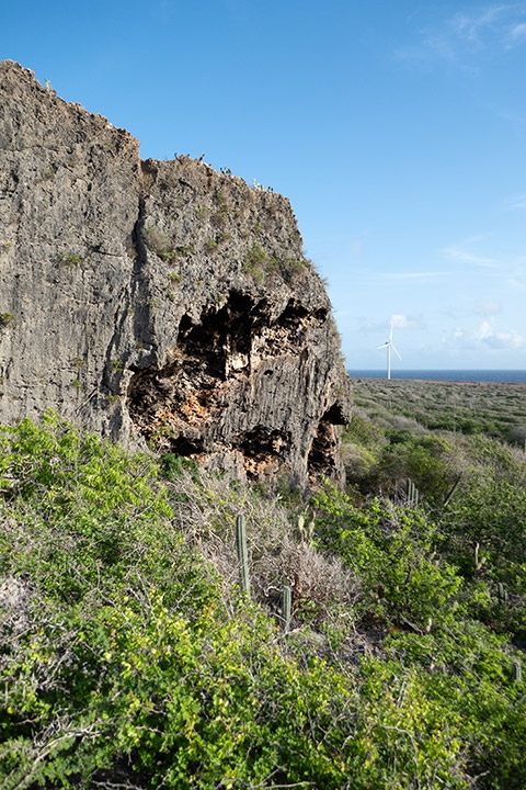
Hike from the parking lot of Seru Pretu snack to the most Eastern part of the former plantation of Santa Catharina and part of the Koral Tabak area. First the hike goes to the Koral Tabak Area where a presumed Indian cave can be visited. Inside is a small statue with a face. Then the hike continues to the coast to the first bay on this hike, Boka di Mangel. Then further along the coast where the border between the two areas will be crossed before two other bays are visited, Boka Grandi and Boka Labadera. Then the hike returns to the starting point via a dirt road along the former plantation house of Santa Catharina.

Highlights of this trip:

  • the walk along the Northern shore
  • Indian cave
  • Boka di mangel
  • Boka grandi
  • Boka Labadera
  • Plantation house Santa Catharina (optional)

Read more: Santa Catharina - Eastern side and Koral Tabak

Santa Catharina - Middle area

Details
02 August 2020
  • Total distance km: 7.5
  • Difficulty: Easy
  • Terrain: Mostly level, Possibly moist
  • Duration (hours): 3

Santa Catharina Middengebied
Hike from the parking lot of Seru Pretu snack to the Northern coast via a dirt road along the plantation house of the former plantation of Santa Catharina. After a visit to two bays on the coast, Boka Labadera and Boka Grandi, via another dirt road parallel to the first one back to the starting point. In this way the middle area of the former plantation will be visited including the plantation house (optional).

Highlights of this trip:

  • the walk along the Northern shore
  • Boka Labadera
  • Boka Grandi
  • Plantation house Santa Catharina

Read more: Santa Catharina - Middle area

Bahada di Daniel

Details
02 August 2020
  • Total distance km: 7
  • Difficulty: Moderate
  • Terrain: Hilly, Rough / sharp
  • Duration (hours): 4 - 5

Bahada di Daniel
Hike over Bahada di Daniel; that is the area behind plantation house Daniel till the Hato Plains. There are several terraces there that you will cross during this hike. That means there is some climbing involved to go from terrace to terrace. The underground consists mainly of eroded limestone which is sharp. 

Highlights of this trip:

  • Beautiful views
  • Two caves that can be visitied (optional)
  • Historical landmarks such as old stone walls and "the pillars of Jay"
  • Plantation house Daniel where you can take a coffee or meal; also visit the beautiful painting collection of the owner inside the plantation house

Read more: Bahada di Daniel

Around the Jan Thiel lagoon

Details
07 March 2018
  • Total distance km: 10
  • Difficulty: Easy
  • Terrain: Mostly level, Possibly moist
  • Duration (hours): 3.5 - 4

Rondom JanThiel lagune
Hike around the lagoon of Jan Thiel. The first part of the hike is through Parke Sorsaka to the area near the Jan Thiel lagoon. From there the hike continues mostly close to the shore of the lagoon in a counter clockwise direction. The last part is once again through Parke Sorsaka

Highlights of this hike

  • the historical bridge and a large well in Parke Sorsaka
  • a nice Mazaliña forest and a forest of Mangrove trees
  • beautiful nature along the path
  • view on the lagune
  • remnants of a lime kiln
  • saltpans

This is quite a long hike over mostly flat terrain. At some place the area can be muddy or even wet. So keep this in mind when selecting shoes for this hike.

Read more: Around the Jan Thiel lagoon

More Articles …

  1. Vaersenbay to Boka Sami and back
  2. Parke Sorsaka and Jan Thiel Lagoon
  3. Seru Jamanika
  4. Malpais
  • 1
  • 2
  • 3

Page 1 of 3

  1. You are here:  
  2. Home
  3. Hiking