Hike over Bahada di Daniel; that is the area behind plantation house Daniel till the Hato Plains. There are several terraces there that you will cross during this hike. That means there is some climbing involved to go from terrace to terrace. The underground consists mainly of eroded limestone which is sharp.
Highlights of this trip:
- Beautiful views
- Two caves that can be visitied (optional)
- Historical landmarks such as old stone walls and "the pillars of Jay"
- Plantation house Daniel where you can take a coffee or meal; also visit the beautiful painting collection of the owner inside the plantation house
This is a rather long hike. Because of the sharp underground and the the fact that you have to move from terrace to terrace the pace will not be high and that means that it can take up to 5 hours to complete this hike. So take sufficient water and some snacks with you and don't walk alone. Also bring shoes with a good sturdy sole.
Parking
The car can be parked either along the secondary road, if you are early (early bird entrance of the trail) or at the parking lot of plantation house Daniel.
Description of the trail
For a map of the trail check the download link below under the heading "Trail map". Also the track is available for download there.
The trail is indicated with yellow stones and can be followed by looking for these. In case you have the impression that you are not on the right track you probably are indeed not on the right track. Always look around when in doubt how to proceed.
I started my hike from the "early bird entrance" to the trail. When starting at plantation house Daniel you will get to the same trail after a short while. Remember where you came from because you have to take the same path to end up at your car at the end of the hike.
After a while you get the choice between going right or left. I took the right side but either choice is good. The only difference is that you walk the trail in the opposite direction. Taking the right side you will cross an old stone wall. That is the former border between the plantation Daniel and the area of Tera Kòrá. Continue along the trail till you reach an entrance into a rooi (dry river bed, contains only water after heavy rainfall). Take this rooi till you reach the end of the terrace. Enjoy the view but don't descend here unless you have the right climbing equipment. Go back a short while looking for the continuation of the trail out of the rooi marked by yellow stones. Take that path to reach a better point to descend to the lower terrace. There the descend is more manageable.
Continue following the yellow stones. You will pass three of the "pillars of Jay" as described in my article about a trip by the Working Group Archaeology of Curaçao. Unless you pay attention you will probably miss these. They are just heaps of stones but purposely built. Their history is still not known. There are several of these pillars as we called them but only three are in the vicinity of the path.
Shortly after passing the pillars you have to take a decision; either you continue to the Kueba Mirador or you take a shortcut called Hanchi di Sombra. You can enter the Kueba mirador and most probably enjoy a view as the name suggests. I entered but did not continue far into the cave because the ceiling is very low and my bad back doesn't allow me to cross that part. But feel free to do that. Then continue along the marked path; the Hanchi di Sombra trail joines the path so both trails are once again the same. You walk along an old stone wall, which in this case is most probably just a wall to keep cattle in a specified area.
After a short while you reach the top entrance of Kueba di Pachi. You have the option to enter the cave at this point and to descend inside the cave. The other option is to pass that entrance and descend a little farther. When descended to the Hato Plains the path continues along the rock wall. A nice part of the hike. Looking at the droppings you could encounter cows here.
After a while the yellow stones direct you to go uphill to the next higher terrace. After a while there is another climb to a slightly higher terrace. From there you continue to the rock wall between this terrace and the next higher one. Always look out for bees when walking close to the rock wall. I did not encounter any but you never know.
After the climb to the highest terrace you continue the trail till you reach the original path. Follow that path back to your car. If you are parked at the plantation house you could take a rest there and enjoy a drink or meal.
Track of this hike on Wikiloc
Link to the track of this hike on Wikiloc (opens in a new window).
The track can be downloaded but a better option is to install the Wikiloc app on your smartphone; when you click on the download link with the app installed on your phone the link opens in Wikiloc (can take some time) and you are able to follow the track.
It appears that this only works for the paid Premium version of this app.
As an alternative the free version of the Locus Map can be used. To use this app you need to download the track in GPX-format either from Wikiloc or directly from this page (see below under "Trail map").
Location
Pictures
 Plantation House Daniel is still visible
 Warning! Be well prepared for this hike
") A nice Palu di sia (Gum tree)
A nice Palu di sia (Gum tree) Enjoy the view but don't descend here!
 Looking back at the place were we descended
 Old trees along the path
 Strangely formed cactus
 Careful! Bringamosa, don't touch!
 One of the pillars
  Old stone wall
 Inside the cave Kueba mirador
 Inside the cave Kueba mirador
 Descend to the next level down
 Hato plain
 Walking between the rocks
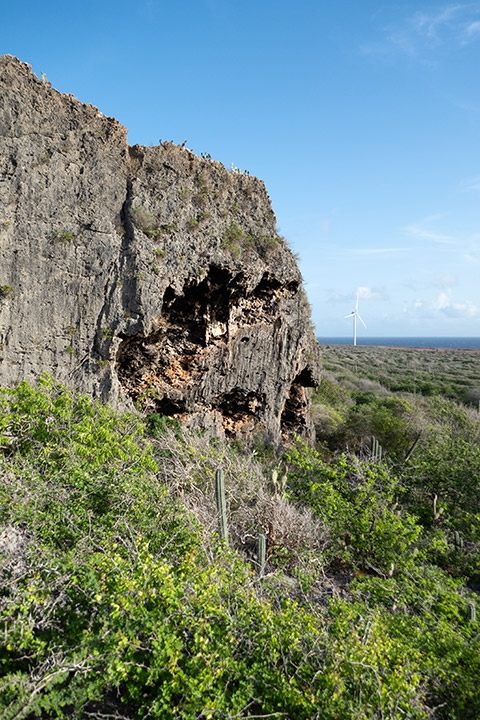
 Wind mills provide electricity
 Hike along the former cliff


")


Trail map (download)
Map with route; right click and Save As GPS track Visit Website